XB-IMG-129229
Xenbase Image ID: 129229
|
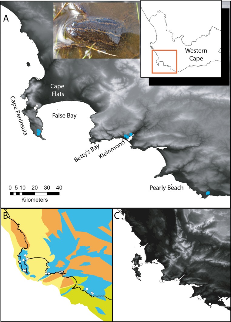
Figure 1. Xenopus gilli sites in the southwest of South Africa.(A) Sampling sites for the present study, squares indicate where Xenopus gilli was sampled for this study. A triangle denotes an introduced population (Measey & de Villiers, 2011), and the white filled circle the presumed type locality: Silvermine River. Note that the squares are distributed in three disjunct areas at the end of the Cape Peninsula near the towns of Kleinmond and Pearly Beach. (B) Vegetation types (after Mucina & Rutherford, 2006) and their projection onto the exposed Agulhas bank after a 120 m reduction in sea level (current coastline is shown as a black line) following Compton (2011). Note that current and historical sites for X. gilli (circles) are associated with lowland Sand-stone fynbos (blue) and not with Sand fynbos (yellow), Renosterveld (brown) or Strandveld (green). (C) Relief map of the same southwestern Cape region after a 25 m increase in sea level. Note that the Cape peninsula becomes two islands separated from the mainland by inundation of the Cape Flats. X. gilli sites in Betty’s Bay and Kleinmond are separated from those at Pearly Beach by high ground and a salt-water estuary. Image published in: Fogell DJ et al. (2013) © 2013 Fogell et al. Creative Commons Attribution license Larger Image Printer Friendly View |